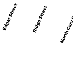
N CARY ST
Owner Information
BENNETT DAVID T
433 N CARY ST #2
BROCKTON, MA 02302


Property Details
N CARY ST is classified as a Accessory Land with Improvement.
N CARY ST is valued at $41,200. The land is valued at $27,200 and the structures are valued at $14,000. There is an additional valuation of $14,030 on this property.
This property is in Zone R1C. Confirm with local Zoning Board authorities to ensure there are no overlays or other easements on this property.
The most recent deed for N CARY ST is recorded at the local registrar in Book 31253, Page 238. N CARY ST was last sold on Wednesday, August 31, 2005 for $302,000.
Assessment data from fiscal year 2021.
Flood Data
According to the FEMA National Flood Hazard Layer, this property does not appear to be in a flood zone. It may also be in an area not yet reviewed. Nonetheless, confirm this information prior to taking any action.
To view the flood hazards around this property, create a FEMA "Firmette" Map of the area around N CARY ST.
Broadband Internet Providers
| Provider | Type | Bandwidth (mbps) | |
|---|---|---|---|
| Verizon New England Inc. | DSL | 5 | 0 |
| GCI Communication Corp. | Satellite | 0 | 0 |
| T-Mobile | Fixed Wireless | 25 | 3 |
| VSAT Systems, LLC. | Satellite | 2 | 1 |
| HughesNet | Satellite | 25 | 3 |
| Viasat Inc | Satellite | 100 | 3 |
| Comcast | Cable | 1000 | 35 |
Broadband service provider data from December 2020.
Adjacent Properties
- 419 N CARY ST
Two-Family Residential owned by INGEMI ANTHONY F JR - 433 N CARY ST
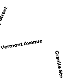
Two-Family Residential owned by BENNETT DAVID T - 88 GRANITE ST
Single Family Residential owned by BROGLIN KIMBERLIN - 38 VERMONT AV
Single Family Residential owned by PACE FRED M - 42 VERMONT AV
Single Family Residential owned by LAWSON JENNIFER - 32 VERMONT AV
Single Family Residential owned by JORGE JOSE - 28 VERMONT AV
Single Family Residential owned by PHILBIN MICHAEL S